Module 3: Introduction to ERDAS Imagine and Digital Data
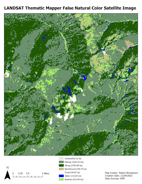
Module 3 of Photo Interpretation and Remote Sensing covered Electromagnetic Radiation (EMR) and calculating wavelength, frequency, and energy that is transmitted. The below map was created using data from ERDAS Imaging that shows a subset of a LANDSAT Thematic Mapper False Natural Color satellite image.

Comments
Post a Comment