Module 1 Lab: Visual Interpretation
Visual interpretation is a way of extracting features from an aerial photograph. One technique involves using visual characteristics of an image. These characteristics include size, shape, tone, texture, pattern, and shadow.
The first
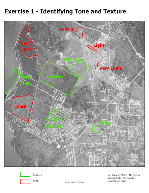
part of the lab involved the use of tone and texture to extract features. The
tone element refers to the brightness or color of an object based on the amount
of light reflected from an object. Objects that are darker have less light
reflected. Objects that are lighter reflect more light. The texture element
determines the visual smoothness or coarseness of the image. The variations of
tone and texture elements help to bring out different features in the
landscape. The map below shows the use of tone and texture to interpret
features from an 8-bit aerial image.


Comments
Post a Comment