GIS 5935 Lab 4 - Surface TINs and DEMs
Lab 4 of GIS 5935 involved using Triangulated Irregular Network (TIN) and Digital Elevation Model (DEM) to visualize the surface of the ground. A TIN represents the earth surface using linked irregular shaped triangles with three dimensional coordinates at each of the vertices. A DEM represents the ground as a two-dimensional raster where each grid cell has an elevation value.
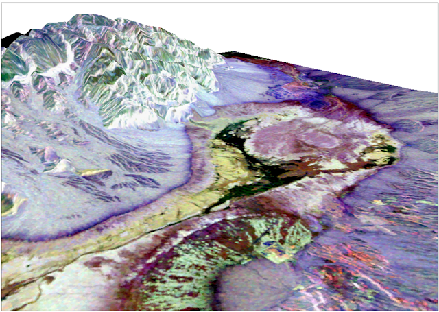
The first part of the lab was to drape an aerial image on top of a TIN. Below is an image of the Furnace Creek aerial drape over the TIN that represents the earth’s surface.
The next part of the lab was to determine
suitable land for a potential ski run using a provided DEM. This involved building
a suitability model that ranked land based on elevation, slope, and aspect
ratio. Each dataset was reclassified based on the rankings and then merged into
one feature class using a weighted overlay. The following ski run suitability
map shows the results.

Below is map of a TIN that is shaded
based on elevation and also shows the contours and TIN triangles.

The maps below show contours that
were produced from the TIN and DEM. The X points marks are the original points
used to create both the TIN and the DEM.


Comments
Post a Comment