Module 6 – Corridor Analysis
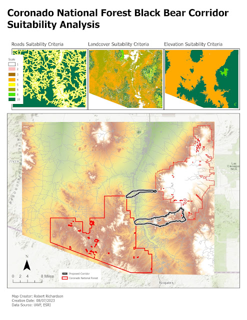
The fourth scenario for Module 6 was to do a Black Bear corridor analysis for connecting the two protected areas of the Coronado National Forest. Black Bear like to stay away from roads, prefer mid-elevation areas, and prefer forest and other vegetation areas. The first step was to create a distance raster for the roads using Euclidean Distance tool and reclassified the raster to the desired suitability values. The elevation and landcover was also reclassified to the desired suitability values. The reclassed roads, elevation, and landcover were then used as inputs to the Weighted Overlay tool produce a raster with a common scale. The scale was inverted to make the higher suitability the preferred trave cost. A cost distance raster was created for each of the two National Forest parts using the inverted suitability raster. The two cost distance raster layers were used as inputs to the Corridor tool which produces the final corridor analysis.
The map below shows the proposed corridor areas.


Comments
Post a Comment