Module 3 - Visibility Analysis
Module 3 lab was all about visibility analysis, which deals with determining how well objects can be seen by an observer or observers given the 3D surface and height of other objects in the 3D scene. The module had us complete four ESRI online training courses that pertained to visibility analysis.
Introduction to 3D
Visualization
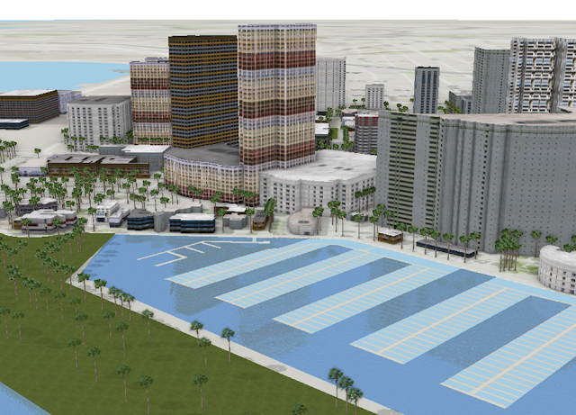
This course discussed how to visualize 3D data in ArcGIS Pro using the scene viewer. The course discusses the difference between local scene and global scene views and when it is appropriate to use each of the views. The course also discussed that every object in a 3D scene needs an elevation source and that an elevation type needs to be chosen to display the object on the ground, relative to the ground, or use an absolute height. Extrusion can also be done on 2D objects to create 3D objects. The images below is a 3D scene of downtown San Diego with extruded trees and realistic multipatch 3D buildings.
Performing line of sight
analysis
This course utilizes ArcGIS Construct
Sight Lines and Line of Sight 3D Analyst tools to determine if observers on a
building roof top can visibly see the proposed parade route. The image below
shows the line of site (green lines) from two observers viewing a proposed parade
route with 600 feet visibility.
Performing viewshed analysis in
ArcGIS
This course discusses viewshed
analysis that creates an output raster that shows all areas that are visible from
one or more observer’s vantage points. The below image shows the area illuminated
(area in red) by 4 lights given the angle and distance of the light at 3 meters
high.
The below image shows the area illuminated
(area in red) by 4 lights given the angle and distance of the light at 10
meters high.
Sharing 3D Content using scene layer packages
This course discusses how to author a 3D scene and share the
scene to the public using a scene layer package. The Create Scene Layer Package tool is used to
publish an active 3D scene to ArcGIS Online The image below shows a view of the
3D scene which can be view at the following link:


Comments
Post a Comment